Exploring Use Cases:
Validating Carbon Emission Data


Econetix offers a comprehensive solution for ensuring accurate and transparent data while actively contributing to the development of a greener planet and the fulfillment of UNIDO's Sustainable Development Goals.
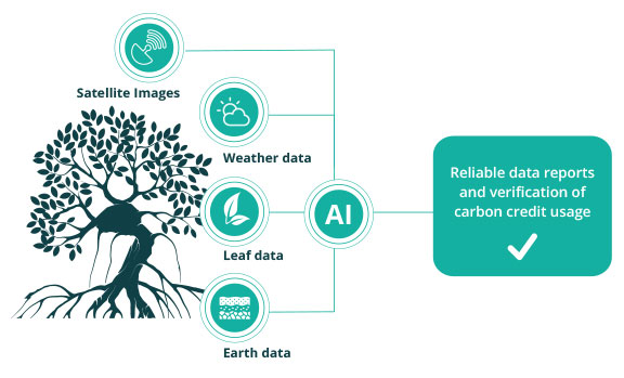
Through the implementation of MyDataPlanet, an loT platform that leverages smart sensors and advanced Al technologies, any area can be effectively monitored. By integrating real-time weather data and satellite imagery, this groundbreaking solution delivers accurate evidence-based data for carbon credit usage.
BlueFutures
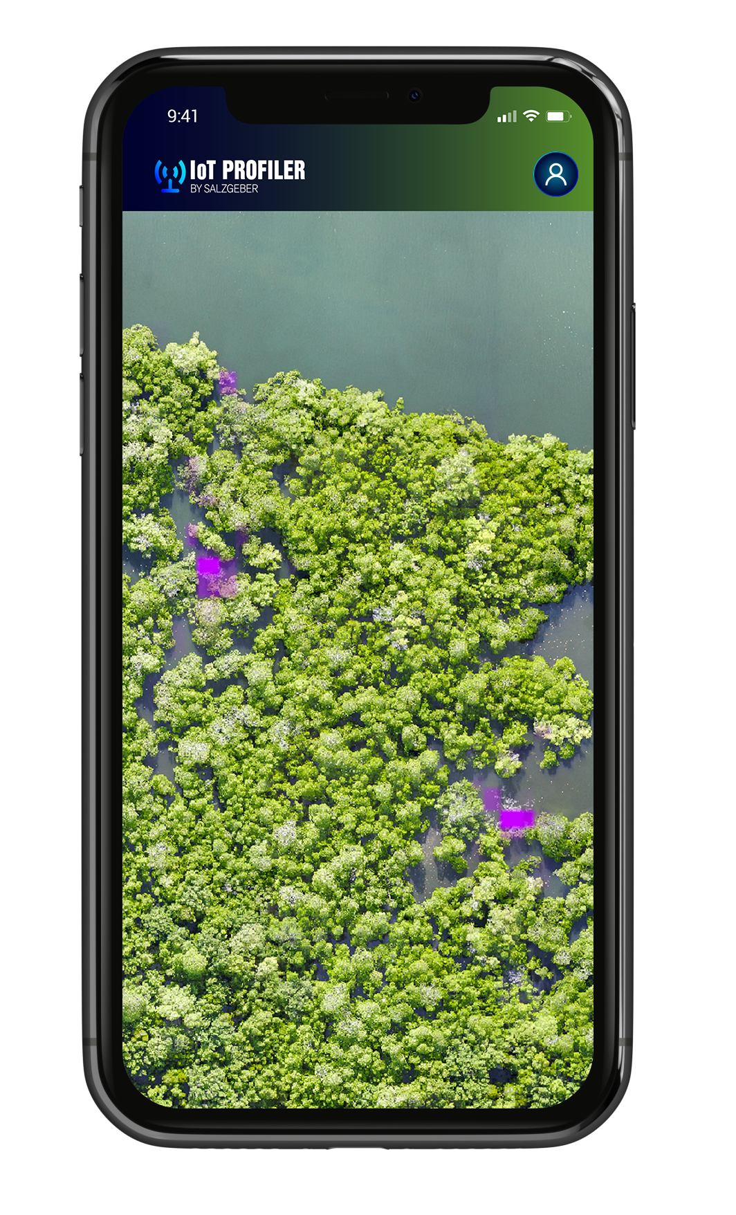
Mangroves
Combining satellite images, earth and leaf sensors, and weather data provides accurate proof of carbon emissions and validates carbon credits. The integration of Al further enhances the algorithms used in this process. For instance, if the satellite images indicate a higher presence of brown leaves or dead trees, the weather data can be used to confirm or discredit the collected information, ensuring the reliability of the data.
GreenFutures
fire hazard
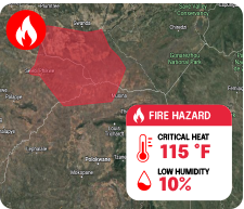
Implementing an early detection system for forest fires using smart sensors, MyDataPlanet minimizes the risk and helps to quickly contain a fire, thereby saving CO2-reducing trees.
These smart sensors continuously gather important data on temperature, humidity, and smoke development, sending it in real-time to a central monitoring system.
YellowFutures
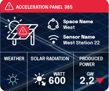
Solar panel control
By continuously monitoring the system, MyDataPlanet can quickly identify any discrepancies and determine whether the system is delivering on its promises or not. With the ability to detect any acceleration in panels or other potential issues, such as dust deposits, the need for costly and time-consuming manual controls becomes irrelevant.
Adjustable and reliant alert system
Task automation system for efficient problem-solving
Accurate data reports and documentation
satelite imaging
Real-time integration through API for daily or monthly data, along with historical views and documentation, surpassing the need for elaborate drone shots.
WEATHER STATIONS
Access to real-time data, historical data, and precise forecasts for comprehensive insights.
IoT NETWORK
Effortlessly deployable battery-run sensors transmit data to our advanced network for efficient analysis.
SUSTAINABILITY TV
Solar-powered cameras deliver live images, combined with sensor data, for enhanced reliability and verification.
ARTIFICIAL INTELLIGENCE
Machine learning, a branch of artificial intelligence, offers numerous benefits that extend beyond algorithmic insights.
By integrating AI learning, businesses can enhance efficiency and accuracy while also contributing to the reduction of their carbon footprint.